Another stretch of dangerous summer heat across Arkansas is bringing back memories of 1980, when a deadly combination of triple-digit temperatures, drought, limited nighttime relief and fewer air-conditioned homes created one of the most punishing summers in the state’s recorded history.
Much of Arkansas entered the final week of July 2026 under heat advisories or extreme heat warnings. The National Weather Service forecast actual temperatures ranging from the middle 90s to more than 100 degrees, with heat-index readings between 105 and 115 degrees or higher.
Forecasters also warned that overnight temperatures in some communities could struggle to fall below 80 degrees, providing residents with little relief after sunset. Dangerous heat is expected to continue into the middle of the week, with above-normal temperatures remaining possible as August begins.
Despite the oppressive conditions, meteorologists cannot yet classify the summer of 2026 alongside 1980 because the current meteorological summer will not end until August 31. Final temperature, rainfall and drought statistics will be needed before a complete comparison can be made.
However, the prolonged heat has already caused many Arkansans to remember the summer of 1980—a season that continues to serve as the state’s benchmark for sustained triple-digit temperatures and the devastating human and agricultural consequences of extreme heat.
Little Rock Recorded 47 Triple-Digit Days in 1980
National Weather Service records show that Little Rock experienced 47 days with temperatures at or above 100 degrees during 1980, the highest annual total in the city’s official climate record.
That corrects some frequently repeated historical accounts that list the total as 42 or 46 days.
The most relentless period began July 5, 1980, and continued through July 19. Little Rock reached at least 100 degrees on 15 consecutive days, which remains the city’s longest officially recorded streak of triple-digit temperatures.
A second prolonged stretch followed from August 6 through August 15, giving the capital city another 10 consecutive days at or above 100 degrees.
Little Rock also recorded 12 days at or above 105 degrees during 1980—another record listed by the National Weather Service.
The city reached 109 degrees on July 17, 1980. Although other Arkansas locations reported even higher readings that summer, 109 remains among the hottest official temperatures ever recorded at Little Rock’s Adams Field.
The 1980 summer had an average daily high of 97.29 degrees in Little Rock, making it the second-highest summer average maximum in the city’s climate history. Only the summer of 1954, with an average high of 97.61 degrees, ranked higher in the National Weather Service report.
Temperatures Reached 112 Degrees in Parts of Arkansas
Temperatures reached approximately 111 degrees in portions of Arkansas during the most intense part of the 1980 heat wave, with readings of 112 degrees reported at Beedeville and Batesville.
Hot Springs experienced its own extraordinary streak, recording approximately 15 consecutive days at or above 100 degrees. Temperatures there reportedly climbed as high as 109 degrees.
The 112-degree readings were extraordinary, but they did not establish Arkansas’ all-time temperature record.
According to the National Weather Service, the official statewide record is 120 degrees, measured at Ozark in Franklin County on August 10, 1936. Claims that Ozark reached 115 degrees on August 10, 2012, to establish the Arkansas record are incorrect; that date is sometimes confused with the actual 1936 record.
Little Rock’s all-time high is 114 degrees, recorded on August 3, 2011—not Fort Smith, as some online comparisons have incorrectly stated.
These distinctions demonstrate why weather comparisons must use individual reporting stations and official climate records. A temperature reported at Little Rock cannot automatically be treated as the statewide maximum, and heat-index readings should not be confused with actual air temperatures.
Drought Made the 1980 Heat Even More Destructive
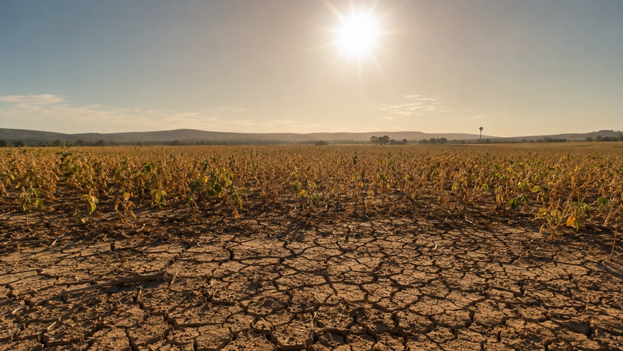
Extreme heat was only part of the disaster in 1980. The heat arrived after an unusually dry June, leaving fields, pastures and soil with little moisture before the most intense temperatures developed in July.
Little Rock recorded only about half an inch of rain during June 1980. The lack of moisture allowed the ground to heat more rapidly and placed immediate pressure on crops, livestock, wells, municipal water systems and electric utilities.
Conditions were especially severe in eastern and northeastern Arkansas. Jonesboro reportedly received almost no measurable rainfall during July and August, recording only a small fraction of an inch over the two-month period.
Soybean, corn and livestock producers faced enormous losses. Crops withered in fields, pastures turned brown, ponds and shallow wells declined, and farmers struggled to keep animals supplied with water.
Unlike a flood, tornado or severe thunderstorm, drought damage does not occur in a single moment. Losses accumulate day after day as rainfall fails to arrive and excessive temperatures repeatedly pull moisture from the soil.
That combination made the summer of 1980 especially destructive for Arkansas agriculture.
Heat Placed Unprecedented Strain on Utilities and Water Systems
Arkansas Power & Light and other utilities experienced unprecedented electricity demand as residents attempted to cool homes and businesses.
Even so, air conditioning was far less universal in 1980 than it is today. Many older homes had no central cooling system, and some elderly or low-income residents could not afford to operate the equipment they had.
Municipal water systems also experienced extraordinary demand. Some communities implemented conservation measures as residents used additional water for drinking, livestock, lawns and crops.
The lack of air conditioning, fewer formal cooling centers, limited public-warning systems and a less-resilient electrical grid made extreme heat considerably more dangerous than a similar temperature would be today.
Modern forecasting, improved medical care, widespread air conditioning, emergency text alerts and public cooling centers now provide Arkansas residents with layers of protection that were unavailable or far less common in 1980.
Those improvements do not make the current heat harmless. They help explain why similarly high temperatures do not always produce the same number of deaths.
How Deadly Was the 1980 Heat Wave?
The nationwide 1980 heat wave is blamed for at least 1,700 deaths, although historical estimates vary depending on whether researchers count only deaths directly attributed to heat or include excess deaths involving heart, respiratory and other medical conditions.
Some accounts have claimed that more than 120 people died in Arkansas. However, that number should be treated cautiously unless it is linked to a verified Arkansas health or government record.
A frequently repeated National Weather Service figure of 120 heat-related deaths during July 1980 applies to Alabama, not Arkansas.
There is no dispute, however, that the heat wave caused widespread illness and deaths across Arkansas and much of the central United States. The elderly, people without air conditioning, outdoor workers, residents with chronic medical conditions and those living alone faced the greatest danger.
Heat-related deaths are also historically undercounted because extreme temperatures can aggravate heart disease, kidney disease and respiratory problems without heat necessarily being listed as the primary cause on a death certificate.
How 1980 Compares to 2011 and 2012
Arkansas experienced two more exceptional periods of heat and drought in 2011 and 2012, but each summer had different characteristics.
The summer of 2011 produced some of the highest temperatures and warmest overnight readings in Arkansas history. Little Rock reached its all-time local record of 114 degrees on August 3, 2011. The overnight low that day was 85 degrees, creating a daily average temperature of 99.5 degrees.
The inability to cool down after sunset made 2011 especially dangerous. Warm nighttime temperatures prevent the human body from recovering from daytime heat and can cause homes without dependable air conditioning to remain dangerously hot around the clock.
The summer of 2012 brought another major drought and several extreme temperatures. Little Rock reached 111 degrees on July 30, while large portions of Arkansas moved into the highest drought categories.
However, neither year surpassed the 47 triple-digit days recorded in Little Rock during 1980. National Weather Service records list 29 days at or above 100 degrees in Little Rock during 2012.
The historical record shows that the summer with the highest individual temperature is not necessarily the summer with the greatest overall impact.
A short period of extreme heat may establish temperature records, but a longer combination of heat, drought, warm nights and limited access to cooling can cause greater human and economic damage.
Comparing the Major Arkansas Heat Waves
Measurement at Little Rock 1980 2011 2012
Highest temperature 109°F 114°F 111°F
Summer average high 97.29°F 95.93°F 95.27°F
Days at or above 100°F 47 Fewer than 1980 29
Longest 100°F streak 15 days Shorter than 1980 Shorter than 1980
Defining feature Duration and drought Extreme peaks and hot nights Severe statewide drought
Statistics can vary by reporting station. The figures above refer primarily to official Little Rock records and should not be presented as statewide averages.
Why 1980 Felt So Much Worse
For many Arkansans who lived through it, the summer of 1980 remains unmatched—not simply because of the thermometer readings, but because of the conditions inside homes, workplaces and communities.
Central air conditioning was less common. Window units could not always keep up with the heat. Utility systems were strained. Public cooling centers were not as widely available, and residents did not receive phone alerts or constant updates from modern forecasting systems.
The drought also magnified the heat. Dry soil contains less moisture to evaporate, allowing more of the sun’s energy to heat the ground and surrounding air.
The relentless nature of the heat also mattered. A 100-degree afternoon followed by a cooler night is dangerous, but repeated days of extreme heat followed by nighttime temperatures near 80 degrees create a cumulative strain on the body.
That is one reason the National Weather Service is emphasizing overnight temperatures during the current 2026 heat wave.
Summer of 2026 Is Not Finished
The present heat is dangerous, but it is too early to declare 2026 a repeat of 1980.
Meteorological summer covers June, July and August, leaving more than a month of weather still to be recorded. Arkansas could experience additional heat waves, drought development or periods of beneficial rainfall before the season ends.
Through late July, the defining feature of the current heat wave has been the combination of high humidity, triple-digit temperatures in some areas, heat-index readings potentially exceeding 115 degrees and unusually warm nights.
In contrast, the summer of 1980 was marked by sustained actual temperatures above 100 degrees, a 15-day triple-digit streak in Little Rock and drought conditions that had already severely depleted soil moisture.
A final determination of how 2026 ranks will require complete National Weather Service and National Centers for Environmental Information data after August 31.
Heat Safety Remains Critical
The National Weather Service advises residents to drink plenty of water, limit strenuous outdoor activity, wear lightweight and light-colored clothing and spend time in air-conditioned buildings whenever possible.
Residents should check on elderly relatives, neighbors, people living alone and anyone without dependable air conditioning.
Children and pets should never be left inside parked vehicles. Temperatures inside a closed vehicle can become deadly within minutes, even when the outdoor temperature is below 100 degrees.
Anyone showing signs of heat exhaustion—including heavy sweating, weakness, dizziness, nausea or headache—should move to a cooler location, drink water and seek assistance.
Heat stroke is a medical emergency. Symptoms may include confusion, loss of consciousness, seizures, hot skin or an extremely high body temperature. Anyone experiencing those symptoms needs immediate emergency medical assistance.
Arkansas may have stronger utilities, better forecasting and more air-conditioned buildings than it did in 1980, but extreme heat remains one of the nation’s deadliest weather hazards.
The summer of 1980 is remembered as a warning of what can happen when relentless heat, prolonged drought and limited access to cooling arrive at the same time.
The summer of 2026 has not yet reached that historical level, but forecasters say the current conditions are dangerous enough to demand serious precautions from every Arkansan.
Sources include the National Weather Service Little Rock climate records, current National Weather Service Little Rock forecasts and National Weather Service statewide Arkansas climate extremes.